GR10 Highlights Hike
Traverse the scenic high mountain passes for breathtaking landscapes
Marvel at the serene beauty of Lac d’Oô
Experience the charm of traditional Pyrenean villages along the route
Explore the historic spa town of Cauterets, surrounded by high mountains and belle-époque architecture
Discover the diverse flora and fauna of the Pyrenees, including native isards and marmots
Hike through the lush meadows near the Hourquette d’Ossoue for panoramic mountain views
Itinerary
Your adventure in the Pyrenees commences in the charming mountain town of Cauterets, nestled at an elevation of 950 meters. As you settle in, the allure of this historic town, famous for its rejuvenating thermal spas, invites you to unwind and immerse yourself in local traditions. If you’ve arrived with time to spare, consider indulging in a soothing experience at Les Bains du Rocher, letting the thermal waters prepare you for the exciting hiking journey that awaits.
First, you’ll take a shuttle to the picturesque Pont d’Espagne, the gateway to France’s oldest national park and a stone’s throw from the Spanish border. Here, amidst the scent of sulfur from nearby thermal springs, you’ll start your hike by ascending to the stunning Lake Gaube. The path then leads you past the enchanting Refuge Oulettes de Gaube, offering breathtaking views of the towering Vignemale glacier. Your day concludes at the Refuge Baysellance, nestled at 2651 meters, the highest-located staffed refuge in the Pyrenees, where you’ll rest under the watchful gaze of the majestic Vignemale, a legendary peak in Pyrenean climbing history.
13.5 km and 1250 m of elevation gain / 110 m of elevation loss
Departing from the refuge, your descent takes you past the Bellevue caves, historical shelters carved in the 1880s for Count Henry Russell’s exploration of Vignemale. As you move towards the charming village of Gavarnie, you’ll traverse a UNESCO World Heritage site, celebrating the region’s unique geology and history. Although your path doesn’t lead directly to the Cirque, famous for Europe’s second-highest waterfall, its grandeur is visible from Gavarnie. Here, you’ll spend the night, with time to explore its cafes, bars, and shops, and enjoy evening strolls with splendid views of the Cirque.
19 km and 440 m of elevation gain / 1600 m of elevation loss
The day begins with a transfer through the valley, offering glimpses of small, traditional villages and their stone-built houses. Starting your hike near the base of the famous Col du Tourmalet, you’ll ascend through idyllic flower meadows and mountain pastures. The trail leads to the Col Madamète at 2509 meters, where the serene lakes Aumar, Aubert, and Lacquettes await in the Néouvielle Nature Reserve. As you traverse this area, keep an eye out for local wildlife like isards and marmots. The journey peaks 2260 meters high at the Col d’Estoudou with panoramic valley views, followed by a gentle descent through the forest to Lac de l’Oule. Here, amidst grazing cattle, you can relax and enjoy a sunset drink on the terrace, concluding your day at the refuge.
15.5 km and 1070 m of elevation gain / 680 m of elevation loss
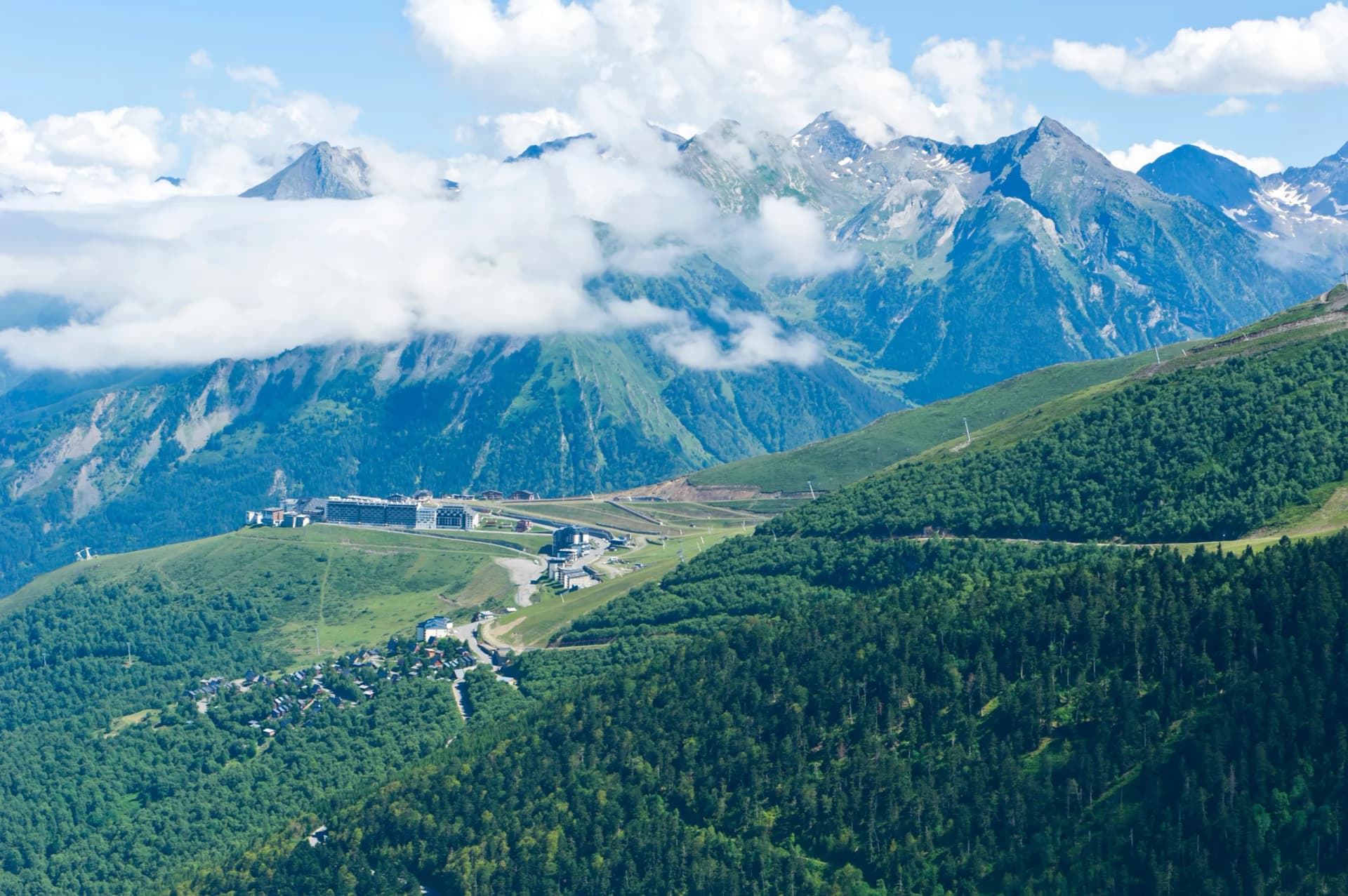
Leaving the Oule refuge, your journey continues as you follow the lake’s edge and ascend to the Col de Portet, reaching an impressive height of 2215 meters, making it the highest road pass in the French Pyrenees. The trail then winds through the ski resort of Saint Lary, traversing high-altitude pastures dotted with cow herds. The last 500 meters of descent lead you to the picturesque town of St-Lary-Soulan. Here, amidst the serene ambiance, you can explore an array of delightful cafes, bars, and shops.
15 km and 400 m of elevation gain / 1400 m of elevation loss
Today’s route presents a more relaxed pace, meandering from Saint Lary and passing through the quaint villages of Estensen, Azet, and Loudenvielle, each boasting their historical charm with ancient water mills and communal washhouses, once the hub of village life. As you ascend through shaded meadows, a high pass eventually reveals a stunning view overlooking Loudenvielle, a town renowned for its proximity to the Col de Peyresourde and as a frequent endpoint for Tour de France stages. The stage culminates with a brisk, one-hour climb to the picturesque village of Germ.
15 km and 1100 m of elevation gain / 650 m of elevation loss
Setting off from Germ, your trail ascends through the majestic Pyrenees, offering sweeping views of the Franco-Spanish peaks. Your climb leads through the Pas de Couret at 2131 meters, a gateway into the picturesque Luchonnais region. The ascent unveils a landscape rich in mountain lifestyle and agricultural heritage. As you approach Espingo Lake, the path meanders through Granges d’Astau, revealing the stunning Lac d’Oô, where you’ll spend the night.
17 km and 1260 m of elevation gain / 1100 m of elevation loss
Departing from the lakeside refuge on your final hiking day, the trail leads to a spectacular waterfall at the lake’s end. The path then zigzags upwards to the Hourquette des Hounts pass at 2275 meters, followed by a descent into a secluded valley. Your journey continues with a climb to the Col de la Coume de Bourg at 2272 meters. The last drop takes you past the Superbagnères ski resort. You can either hike down or opt for the chairlift to reach Bagnères-de-Luchon, over 1000 meters below. With its tree-lined boulevards and an array of bars, cafes, and shops, the town offers a fitting conclusion to your journey.
14 km and 1200 m of elevation gain / 850 m of elevation loss
This tranquil day in Luchon provides a moment of calm, allowing you to absorb the experiences and memories made during your incredible trek through the French Pyrenees. Take your time to stroll along the charming tree-lined streets, perhaps visiting a cafe for a leisurely breakfast or exploring the local shops for souvenirs. As you prepare to leave, the majestic mountains that have been your backdrop offer a final, stunning vista.
Guided
Included in price
Optional Extras
Self guided
Included in price
Optional Extras
What to bring to the tour
Description
In the heart of the French Pyrenees lies a segment of the GR10 trail, a path that weaves through some of the most stunning landscapes this mountain range has to offer. Hikers will experience a journey through nature’s artistry, a trek that encompasses the most picturesque portions of this famous trail.
The path will take you from the historic charm of Cauterets through the lush meadows and towering peaks near Lac d’Oô to the serene grandeur of Bagnères-de-Luchon.
Highlights include the awe-inspiring Pont d’Espagne, the tranquil waters of Gaube Lake, the panoramic views from Col de la Hourquette d’Ossoue, and the lush, pastoral beauty of the Luchonnaises Pyrenees.
While not technically demanding, this hike is a true testament to one’s endurance and passion for hiking. Each day brings significant distances to cover and substantial elevation gains.
The varying altitudes and rugged terrain make it essential for participants to be in the optimal physical condition and used to long days in the mountains. If you’re unsure if you want to take on the entire highlights tour, you can also opt for a 3-day GR10 Hike option.
To ensure you can focus on the beauty and challenge of the trail, we provide a comprehensive support package. From securing comfortable accommodations in the huts, hotels, and auberges to providing unwavering 24/7 support on the route, we take care of the details.
Our detailed GPS navigation tools are designed to guide you through each segment of the trail seamlessly. Additionally, we provide an in-depth travel booklet, rich with information about this panoramic stage of GR10.
Ready to take action? The Pyrenees will be there waiting!
Trail Map
Start planning today!
Things to know
Hut-to-hut hiking is a form of trekking where you hike from one mountain refuge to another, staying overnight at these locations. This style allows you to explore the varied landscapes of the Pyrenees, from high mountain passes to serene valleys, without the need for carrying camping gear. The trails, such as the famous GR10 and GR11, connect different refuges and offer diverse scenic experiences.
Preparation involves physical training, familiarizing yourself with the hiking routes, and ensuring you have the right gear. Start with cardiovascular exercises and hikes to build endurance. Study the specific trails you plan to hike, as each has unique characteristics, and pack accordingly for varying weather conditions and terrains.
While some hiking experience is beneficial, the Pyrenees offer trails suitable for various skill levels. Beginners can enjoy less challenging routes with lower elevation gains, while experienced hikers can tackle more strenuous paths. But most trails in the Pyrenees require some previous experience, mostly due to large distances and elevation gains.
The Pyrenees feature a range of refuges, from basic, unmanned shelters offering minimal amenities to manned refuges with facilities like meals and hot showers. All our hikes include only staffed huts in order to provide the maximum comfort possible.
Sleeping arrangements in Pyrenees refuges vary. Some offer private rooms, while others only have shared dormitories. It’s essential to book in advance, especially during peak seasons, to secure the type of accommodation you prefer.
Refuge etiquette in the Pyrenees centers around respect for shared spaces and other hikers. Clean up after yourself, keep noise levels low, especially at night, and adhere to the specific rules of each refuge.
The ideal season is from late spring to early fall, typically June to September. This period offers more stable weather conditions and open refuges. However, be prepared for rapid weather changes, especially in higher altitudes.
Meals are provided in all staffed refuges, often including breakfast and dinner. Some refuges might offer packed lunches for the next day’s hike. It’s wise to carry snacks, especially for longer hiking segments.
Stay on marked trails, be aware of weather changes, and carry a basic first aid kit. For emergencies, know the local rescue services (112) and have a means to call for help. We provide support and check-ins to ensure your safety throughout your hike.
Although our suggestion would be that they are at least 12 years old, many hikes are suitable for children who are accustomed to hiking and can handle distance and elevation changes. Assess your child’s ability and choose a trail that aligns with their experience and stamina.
Weather in the Pyrenees can vary significantly, with warmer conditions in the lower valleys and cooler temperatures at higher elevations. Summers are generally mild, but conditions can change rapidly in the mountains, so be prepared for all scenarios.
Yes, advance booking is crucial, particularly if you prefer specific types of accommodation or are hiking during the busy season. Refuges, especially the more popular ones, can fill up quickly.
In mild bad weather, such as rain, it’s usually safe to continue your hike with appropriate gear. For severe weather conditions like heavy storms, it’s advised to stay in your current refuge until it’s safe to proceed. Always prioritize safety and follow the guidance of hut wardens or local authorities. We’ll try our best to adapt your itinerary accordingly.
The availability of specific dietary options varies between refuges. Most manned refuges offer vegetarian meals, but vegan options might be limited. It’s recommended to inform the refuge in advance of any dietary restrictions. Carrying additional food items to supplement provided meals is a good practice.
Cell phone reception in the Pyrenees can be spotty, especially in remote areas or higher altitudes. Some refuges may offer Wi-Fi, but it’s not common. Prepare for limited connectivity, which is a part of the remote mountain experience.