Hiking in the Pyrenees: Best 7 Hikes
Explore our guide to hiking in the Pyrenees, covering the best trails, valleys, and peaks across this 430 km mountain range between France and Spain.
Quick links
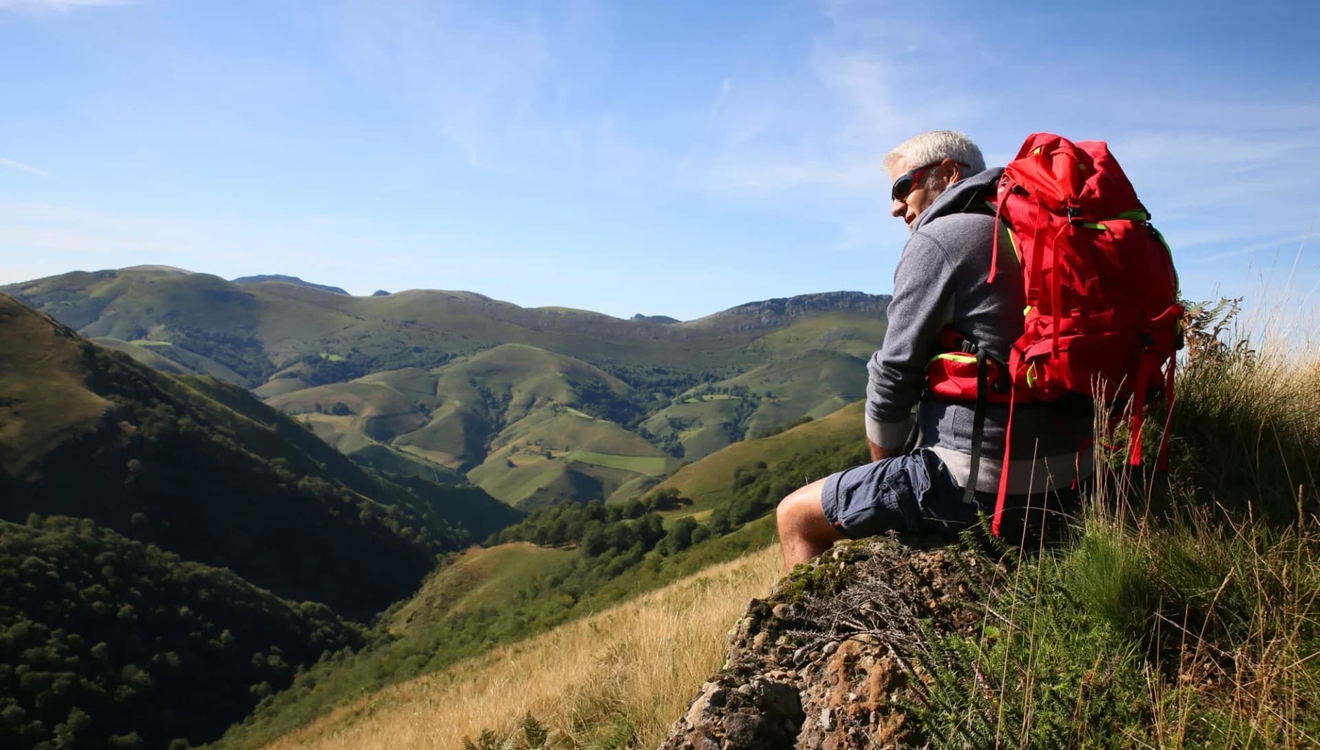
The Pyrenees stretch between the Atlantic Ocean and the Mediterranean Sea, forming a natural border between France and Spain. Covering more than430 km, this mountain range offers an exceptional variety of hiking terrain - forests, valleys, ridgelines, granite peaks, and networks of well-marked trails suitable for all levels.

The region combines accessibility with a genuine mountain atmosphere. Some areas offer gentle paths through woodland and valleys; others climb steeply toward high passes with wide, open views.
Whether you prefer short day walks, multi-day hut-to-hut routes, or a full crossing of the range, the Pyrenees provide a highly flexible and rewarding hiking environment.
What makes the Pyrenees stand out is their variety. On a single trip you may:
Walk through quiet pine or beech forests
Cross rivers and old stone bridges
Reach high passes with panoramic views
Stay in mountain refuges deep in protected parks
Experience peaceful early-morning sections with almost no crowds

This guide covers the essentials for planning your Pyrenees hike: where the mountains are located, how each region differs, the best-known routes, what to pack, and the accommodation options available.
Whether you are hiking independently or joining an organised trip, the Pyrenees offer one of Europe’s most diverse and reliable hiking regions.
Pyrenees National Park and Protected Areas
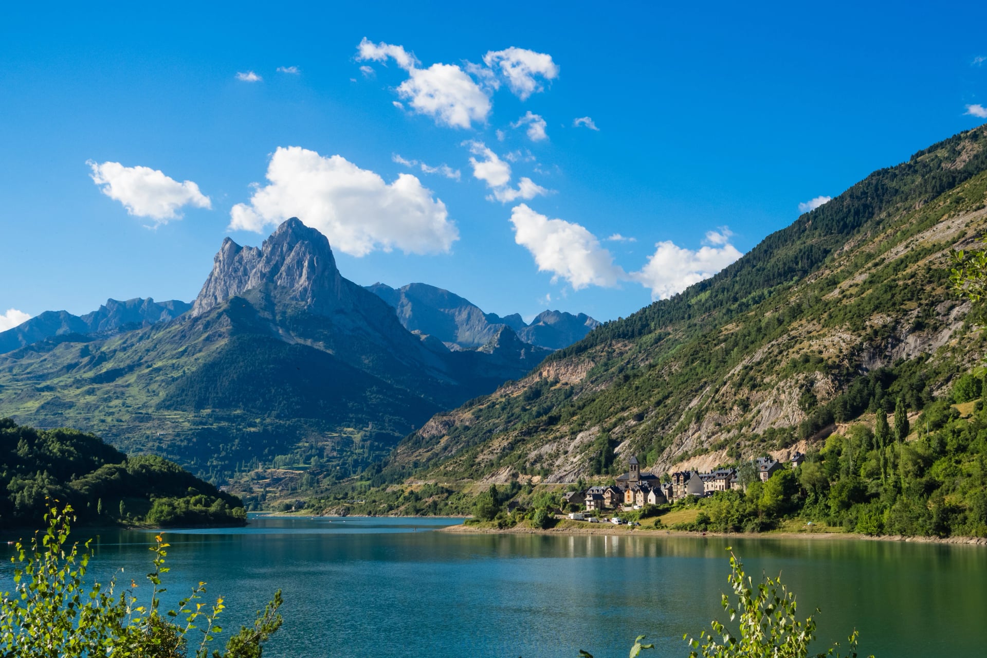
Covers the central French Pyrenees along the border. Known for glacial cirques, lake basins, and well-marked valley trails. Towns such as Cauterets and Gavarnie give easy access, and staffed refuges support summer hut-to-hut hikes.

Ordesa y Monte Perdido National Park (Spain)
One of Spain’s most visited mountain parks, featuring deep canyons, limestone cliffs, and the Monte Perdido massif. Routes range from straightforward canyon-floor walks to more demanding balcony paths.
Aigüestortes i Estany de Sant Maurici National Park (Spain)
A high-altitude area with more than 200 lakes, granite peaks, and well-maintained trails. Popular for day hikes and established multi-day routes between refuges.
Néouvielle Nature Reserve (France)
Compact, accessible, and known for its turquoise lakes and granite ridges. Close to Cauterets and Saint-Lary-Soulan, with plenty of short and medium-length hikes.

Alt Pirineu Natural Park (Spain)
Catalonia’s largest protected area, home to Pica d’Estats, the region’s highest peak. Offers a mix of quiet valleys, ridge routes, and more challenging summit options.
Pyrénées Ariégeoises Regional Park (France)
A quieter part of the range with rolling valleys, limestone massifs, and traditional villages. Good for hikers looking for less-crowded trails and steady, moderate terrain.
Where Are the Pyrenees Mountains?
The mountains are commonly divided into five geographical sections, each with its own hiking style and character.
1. Hiking in the Spanish Pyrenees
The Spanish Pyrenees have long stable periods in summer and early autumn. The terrain rises steeply from the plains of Aragón and Catalonia, producing dramatic landscapes and excellent high-mountain access.
Key characteristics:
Dry, sunny climate with fewer summer storms
Deep canyons such as Ordesa and Añisclo
Granite massifs around Benasque (Aneto and Maladeta)
Strong refuge network and well-marked high-altitude paths
Ideal conditions for mid- and high-altitude hiking from June to October
The Spanish side is a top choice for hikers who prefer clear skies, open terrain, and high-altitude routes that stay accessible for a long stretch of the season. It is also the home of the GR11, which crosses the entire Spanish side of the range.
2. Hiking in the French Pyrenees
The French Pyrenees offer cooler, greener scenery with more Atlantic influence in the west and sharper alpine forms in the central region. Forested valleys, large cirques, and glacial lakes define much of the landscape.
Key characteristics:
Cooler, wetter conditions, especially in the west
Iconic areas such as Gavarnie, Cauterets, Néouvielle, and the Aspe Valley
Varied terrain with strong contrasts between valleys
Extensive refuge network supporting GR10 and hut-to-hut routes
Excellent mix of day hikes, lake circuits, and multi-day options
This side of the range suits hikers who enjoy classic alpine scenery, greener valleys, and a slightly cooler climate. The GR10 traverses the entire French Pyrenees and connects many of its most scenic areas.
3. Western Pyrenees – Gentle, Green, Accessible
Rolling beech and oak forests
Softer, rounded terrain
Ideal for beginners, families, and low-altitude hiking
Mild weather and shorter distances between villages

This region offers easy-to-moderate walks and is perfect for early-season or relaxed hiking.
4. Central Pyrenees – High, Alpine, Dramatic
Highest peaks, including Aneto
Areas like Ordesa, Gavarnie, and Aigüestortes
Deep glacial valleys and steep ascents
Classic multi-day routes pass through here (GR11, HRP, etc.)

This is the most mountainous and visually striking section, home to the iconic high-level terrain the Pyrenees are known for.
5. Eastern Pyrenees – Open, Sunny, Mediterranean Influence
Warmer, drier climate
Long ridgelines and open terrain
Great for late-season hiking
Strong Catalan cultural influence

This area offers excellent transitional-season walking and more stable weather in autumn.
A good map is essential, especially for larger itineraries such as GR10, GR11, Carros de Foc, or Cavalls del Vent, where terrain changes quickly between regions.
Compared to the Alps, the Pyrenees remain less commercialised. There are fewer resort towns, fewer cable cars, and a more traditional rural character. Trails feel natural, villages remain authentic, and encounters with locals or other hikers tend to feel genuine rather than tourist-focused.
For hikers seeking quieter trails, natural landscapes, and a strong sense of place, the Pyrenees offer a dependable and authentic mountain experience.

Best Hikes in the Pyrenees
The Pyrenees offer a wide variety of established routes, ranging from long-distance traverses to shorter circular hut-to-hut options. Below are some of the most recognised and rewarding hikes across the range.
Best Day Hikes in the Pyrenees
The Pyrenees offer a huge range of day hikes, from easy scenic walks to demanding full-day mountain routes. Conditions vary by region, but most day hikes are accessible between June and October, with lower-level routes opening earlier. Below are some of the most established and rewarding single-day hikes across both the French and Spanish sides.
1. Lac de Gaube (France)
Starting Point: Pont d’Espagne, Cauterets
Distance: 7 km (return)
Elevation Gain: 200 m
Time: 2–3 hrs
A classic and accessible lake walk offering clear views of the Vignemale massif. Ideal for beginners or as a warm-up before tackling longer routes.
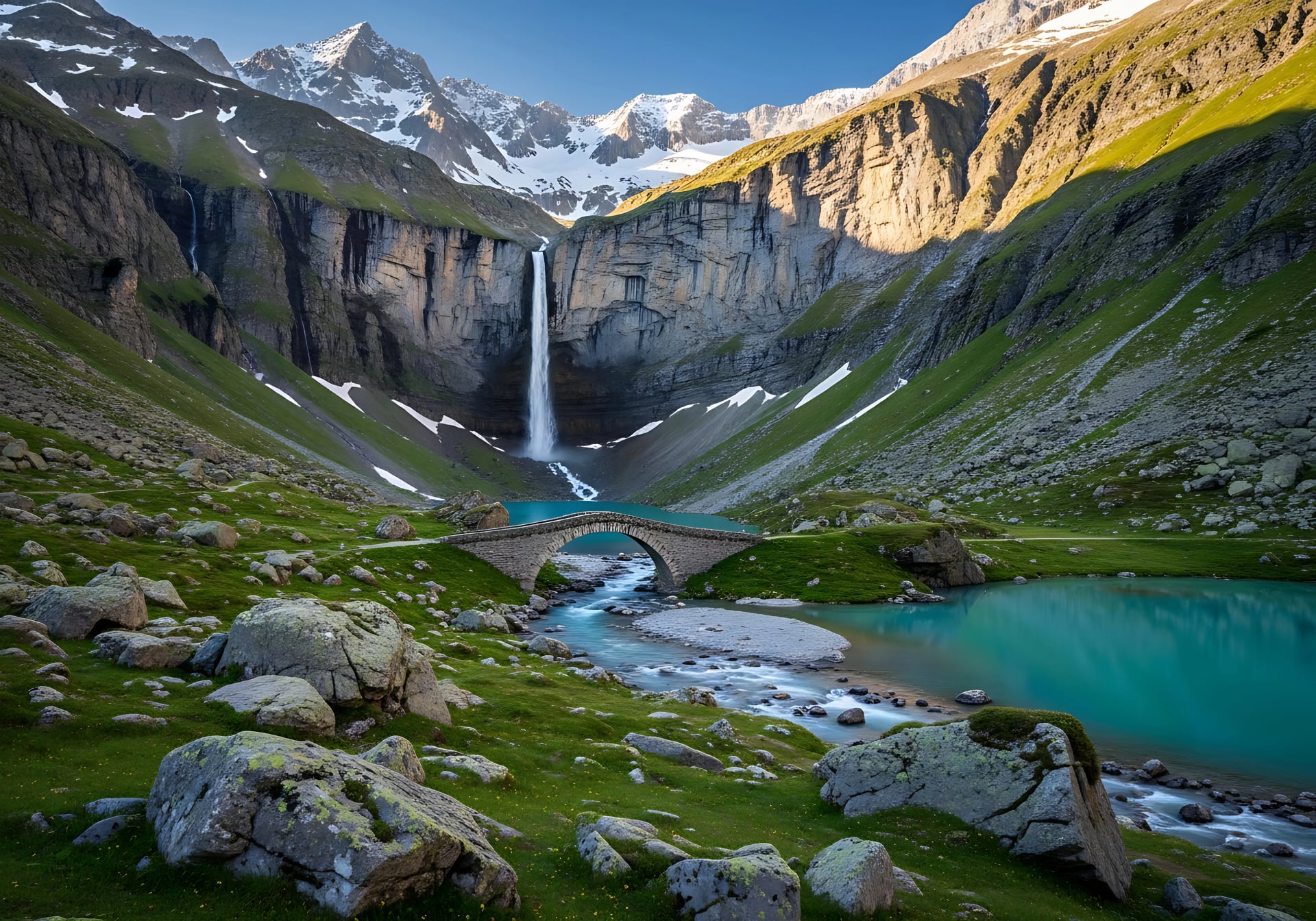
2. Cirque de Gavarnie (France)
Starting Point: Gavarnie Village
Distance: 10 km (return)
Elevation Gain: 300 m
Time: 3–4 hrs

One of the most famous day hikes in the French Pyrenees, leading to the base of a vast glacial amphitheatre and its 422-m waterfall.
3. Ordesa – Cola de Caballo (Spain)
Starting Point: Ordesa (Pradera)
Distance: 18 km
Elevation Gain: 600 m
Time: 5–7 hrs
A long but steady route through the Ordesa Valley, ending at the well-known waterfall “Cola de Caballo.” A highlight of the Spanish Pyrenees.
4. Estany Sant Maurici Loop (Spain)
Starting Point: Espot
Distance: 12–14 km
Elevation Gain: 500–700 m
Time: 4–6 hrs
A scenic loop through Aigüestortes National Park with granite peaks, forests, and iconic lake views.
5. Tristaina Lakes Circuit (Andorra)
Starting Point: Ordino-Arcalís
Distance: 5 km
Elevation Gain: 250 m
Time: 2–3 hrs
A short, rewarding loop visiting a chain of lakes beneath the Tristaina peaks. Suitable for most hikers.
Best Multi-Day Hikes in the Pyrenees
Multi-day routes are the best way to experience the diversity of the Pyrenees. Trails connect through valleys, passes, and lake basins, with refuges providing support through much of the range. Most long-distance routes are fully accessible from July to September, depending on snow.
1. GR 10 (France)
Starting Point: Hendaye
Distance: 875 km
Elevation Gain: 48,000 m
Max Elevation: 2,652 m
Recommended Number of Days: 45 to 60 days

The GR 10 crosses the full length of the French Pyrenees from the Atlantic to the Mediterranean. It combines forest paths, high passes, and regular descents into villages, making it one of the most accessible major long-distance routes. Accommodation is frequent, trail marking is reliable, and the landscape changes significantly from west to east.
2. Cavalls del Vent (Catalonia)
Starting Point: Refugi de Rebost
Distance: 84 km
Elevation Gain: 5,600 m
Max Elevation: 2,513 m
Recommended Number of Days: 3 to 5 days

The Cavalls del Vent loop links eight refuges in Cadí-Moixeró Natural Park. With varied terrain ranging from forested trails to limestone ridges, it provides a well-balanced multi-day hike that is achievable for most experienced hikers. The route is well-marked and hut spacing is comfortable.
3. HRP – Haute Randonnée Pyrénéenne
Starting Point: Hendaye
Distance: 800 km
Elevation Gain: 52,000 m
Max Elevation: 3,404 m
Recommended Number of Days: 50 to 60 days

The HRP is the most demanding of the long-distance Pyrenees routes. Staying close to the high spine of the range, it includes exposed sections, challenging navigation, and remote terrain. Suitable only for experienced trekkers, it offers some of the most dramatic landscapes in the Pyrenees.
4. GR 11 (Spain)
Starting Point: Cape Higuer
Distance: 840 km
Elevation Gain: 39,000 m
Max Elevation: 2,785 m
Recommended Number of Days: 50 to 60 days

The GR 11 runs along the Spanish side of the range. It is generally drier and more rugged than the GR 10, passing through major national parks such as Ordesa, Aigüestortes, and Posets-Maladeta. Regular village access makes resupply manageable despite long, remote stretches.
5. Carros de Foc (Aigüestortes National Park)
Starting Point: Flexible (e.g., Restanca, Ventosa i Calvell, Ernest Mallafré)
Distance: 65 km
Elevation Gain: 4,700 m
Max Elevation: 2,747 m
Recommended Number of Days: 6 to 7 days

The Carros de Foc is a high-altitude loop linking the principal refuges of Aigüestortes i Estany de Sant Maurici National Park. With steep ascents, granite terrain, and numerous lakes, it is physically demanding but well supported by a strong refuge network. Ideal for a 4–7 day hut-to-hut trek.
6. Alta Ruta de los Perdidos
Starting Point: Refugio de Pineta or Refuge des Espuguettes
Distance: 100 km
Elevation Gain: 6,700 m
Max Elevation: 2,900 m
Recommended Number of Days: around 7 days

The Alta Ruta de los Perdidos encircles the Monte Perdido Massif, combining terrain from both the Spanish and French sides of the range. It involves steep climbs, high passes, and rugged routes, offering major highlights such as Ordesa, Gavarnie, and Pineta.
7. Ruta de las Golondrinas
Starting Point: Refugio de Linza
Distance: 74 km
Elevation Gain: 4,100 m
Max Elevation: 2,424 m
Recommended Number of Days: around 6 days

The Ruta de las Golondrinas is a moderate circular route crossing Navarre and Béarn. It follows the historical paths used by Basque women working seasonally in France. The terrain is varied and supported by a small but reliable hut network.
Planning Your Pyrenees Hiking Trip
Planning your trip is an important part of hiking in the Pyrenees. Conditions vary by season, some routes require advance hut bookings, and access differs depending on which side of the mountains you choose. This section outlines the essentials so you can prepare confidently and choose the best time and place for your hike.
When to Go
The Pyrenees offer good hiking conditions for much of the year, but the experience changes significantly with the seasons. Choosing the right time depends on the type of routes you want to do and the level of challenge you’re comfortable with.
The best time to hike the Pyrenees is Summer (July to Mid-September) — see the full seasonal breakdown below.

Late Spring (Mid-May to Late June)
Lower valleys are green and full of flowers
Snow may still block high passes, and huts may not yet be open
Late spring is ideal for lower-altitude walks and early-season hiking. It offers fresh scenery and quiet trails, but higher routes remain unreliable due to late-melting snow.
Summer (July to Mid-September)
All major trails and passes are usually open
Mountain huts are staffed and operating at full capacity
This is the main hiking season in the Pyrenees. Weather is generally stable, long-distance routes are fully accessible, and services are running across both sides of the range. However, popular trails can be busy in peak months.
Early Autumn (Mid-September to Mid-October)
Cooler temperatures and fewer hikers
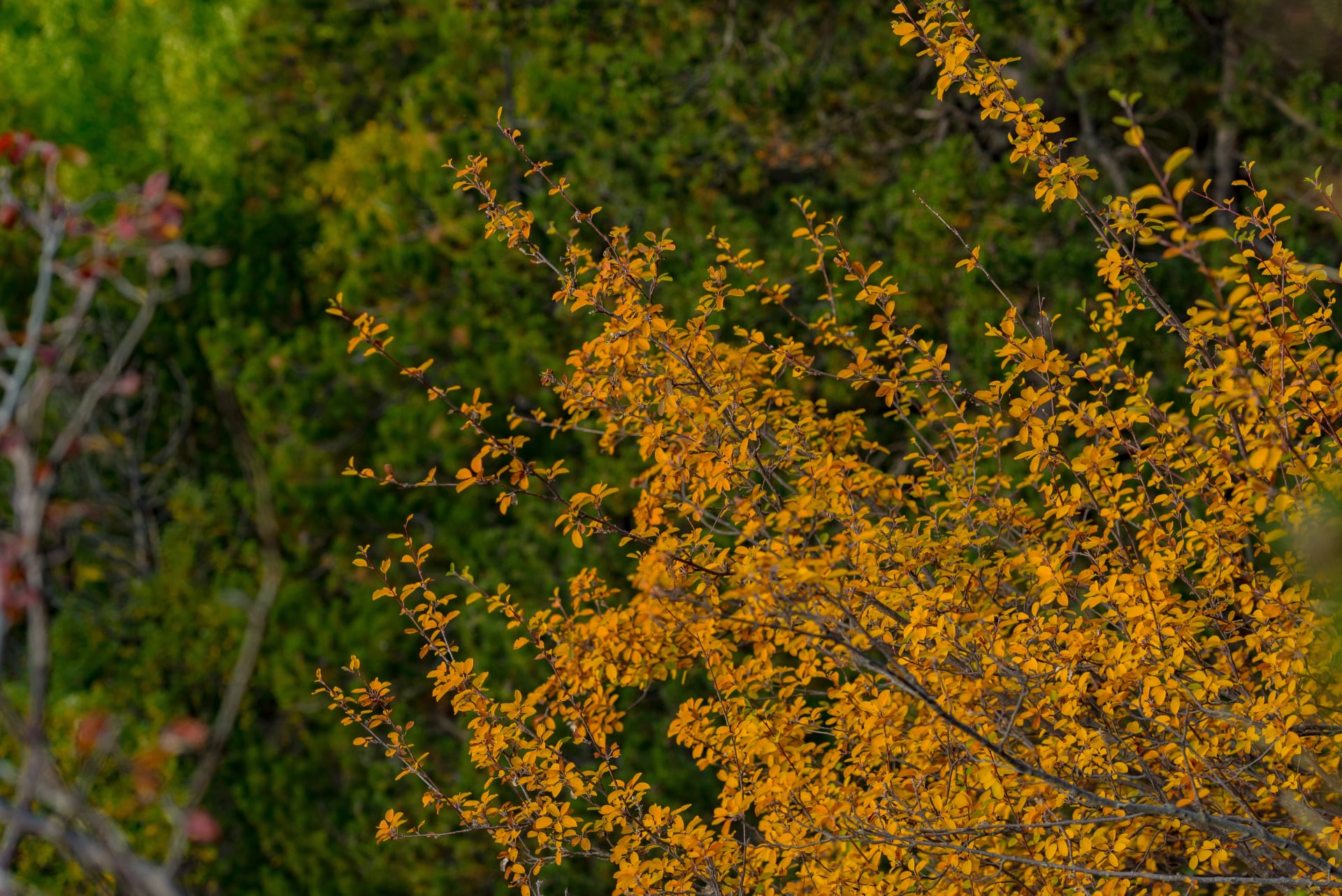
Forests show early autumn colours
Autumn is an excellent time to hike, with stable weather, clear air, and a more relaxed atmosphere on the trails. Some huts close toward the end of September, so planning ahead is important.
Winter & Early Spring (November to April)
High mountains are snow-covered
Many routes become alpine or inaccessible
Winter is suitable for snowshoeing, ski touring, or lower valley walks, but not for most long-distance hiking routes. Only attempt higher terrain with appropriate skills and equipment.
If you want to explore these conditions in more detail, you can check the full seasonal guide here.
How to Get There
Despite their wild appearance, the Pyrenees are straightforward to access from major European cities. Your best entry point depends on the region you plan to explore and whether you’re hiking on the French or Spanish side.
By Air
France:
Toulouse (TLS) – Best for the central and western French Pyrenees
Pau (PUF) – Good access to the western French regions
Spain:
Barcelona (BCN) – Main gateway to the eastern and central Spanish Pyrenees
Zaragoza (ZAZ) – Convenient for Ordesa and nearby areas
Flights to these airports connect easily with regional trains, buses, or car rentals. Most hikers arrive through these major hubs and then transfer to mountain towns such as Cauterets, Benasque, Vielha, Luchon, or Espot.
By Train & Bus
France’s SNCF and Spain’s Renfe networks reach many towns at the foot of the mountains
Local buses or shuttles provide access to trailheads
For remote HRP or GR11 entry points, renting a car offers the most flexibility
Rail access is good for GR10 hikers on the French side, while bus connections support access to GR11 starting points in Spain.
Essential Gear and Preparation
The Pyrenees require sensible equipment rather than specialist gear. Weather can shift quickly, and trails often involve long ascents or rocky terrain, so preparation is key.

Must-Have Items
Sturdy hiking boots suitable for varied terrain
Layered clothing for temperature changes
Waterproof jacket and trousers
Backpack (30–50L) depending on trip length
Navigation tools (GPS, offline maps, or printed topographic maps)
Refillable water bottle or filter
Headlamp with spare batteries
Sun protection (hat, sunglasses, SPF)
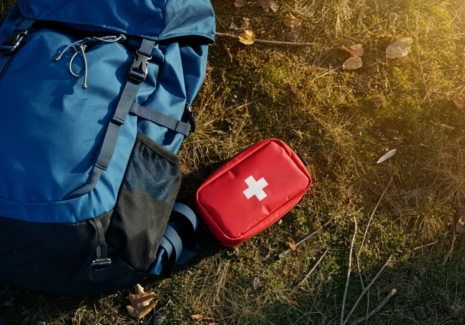
Basic first-aid kit
These essentials prepare you for the most common trail conditions and weather patterns across the range.
Optional but Useful
Trekking poles for steep descents
Sleeping bag liner (required in most huts)
Lightweight snacks or meals for remote routes
Earplugs for shared dormitories
Most hikers find these optional items significantly improve comfort, especially on longer multi-day routes.
Permits, Safety & Etiquette
Most trails in the Pyrenees do not require permits, though some national parks request registration for overnight stays. Weather conditions can change very quickly, especially on high routes, so checking forecasts and being aware of local warnings is essential.
Wildlife is protected, and hikers should follow Leave No Trace principles, keeping noise low, carrying out all waste, and respecting fragile alpine environments.
More safety tips are available in our Mountain Safety Guide.
Fitness Preparation
The Pyrenees involve frequent elevation gain and rocky terrain. Preparation should include:
Regular cardio activity
Leg strength and balance training
Practice hikes with a loaded pack
Long routes like the GR10, GR11, or HRP require endurance and consistency rather than technical climbing experience.
Accommodation in the Pyrenees
Accommodation options range from traditional mountain huts to small hotels and rural guesthouses. Most routes allow flexibility depending on whether you prefer comfort or a more remote mountain experience.
Mountain Refuges (Refugis / Refuges / Refugios)
Mountain huts are the foundation of multi-day hiking in the Pyrenees. They are found along major routes such as Carros de Foc, Cavalls del Vent, GR10, GR11, and the HRP.
You can expect:
Shared dorm-style sleeping
Hot meals
Water and basic facilities
A simple but reliable place to recover

Refuges fill up in summer, especially June to September, so advance booking is strongly recommended. Most huts operate on a half-board basis and do not provide Wi-Fi or reliable phone signal.
The hut system makes multi-day hiking efficient and accessible, allowing you to stay high in the mountains without carrying heavy gear. For names, locations, and practical details, see our full list of Pyrenees Refuges.
Hotels in the Pyrenees Mountains
Small hotels and inns are available in nearly all major mountain towns. Popular hubs include:
Cauterets, Luchon, Luz-Saint-Sauveur (France)
Benasque, Vielha, Espot, Caldes de Boí (Spain)
Hotels often provide hikers with early breakfasts, packed lunches, luggage transfer options, and access to local information. Some towns built around thermal springs also offer spa facilities for recovery.
Rural Guesthouses & Gîtes
Rural guesthouses offer a comfortable and local experience, typically found in quieter villages and valleys. They often include:
Homemade meals using local ingredients
Comfortable rooms
Advice on nearby trails

These stays suit hikers who want a slower pace or who plan to explore a single region in more depth.
Camping in the Pyrenees
Wild camping is permitted in many high-mountain areas but with clear restrictions:
Only above 2,000 m
One night maximum
Pitch at sunset and leave at sunrise
Keep distance from lakes, refuges, and main trails

This is a practical option for HRP hikers or remote sections of the GR11. For more comfort, designated campsites in the valleys offer showers, facilities, and small shops — suitable for road trips or flexible itineraries.
Why the Pyrenees Are Meant to Be Hiked
Hiking is the best way to experience the Pyrenees. The region offers varied landscapes, well-developed trail networks, reliable accommodation, and a strong sense of natural space. Whether you’re tackling a multi-day traverse or spending a weekend on easier routes, the Pyrenees provide a genuine mountain environment without overwhelming logistics or overcrowding.

Walking here allows you to move at your own pace, experience the gradual change in landscapes, and enjoy the sense of progression that only long days on foot can provide.
And if you’re ready to start, we’re here to help. Our self-guided Pyrenees tours give you the freedom to move at your own pace—without the stress of planning. Routes, maps, accommodation, logistics—all carefully arranged so you can focus on the walk, the views, and the moments that make it all unforgettable.
Let the trail be yours. We’ll handle the rest.


HASSLE-FREE
We handle itineraries, accommodations, and anything else you prefer not to deal with, so you can enjoy a carefree hike.

BOOK WITH CONFIDENCE
We are a financially protected company, fully bonded and insured, keeping your money safe and allowing you to travel with confidence.

TRIED & TESTED ADVENTURES
Only the best hut to hut hikes in Europe, cherry-picked by our local team with an in-depth knowledge of the region.

UNBEATABLE SUPPORT
Our 24/7 customer support is where we show our passion, bringing you a better experience by making your well-being our number one priority.