Cavalls del Vent Hike
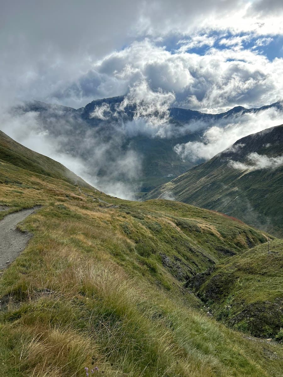
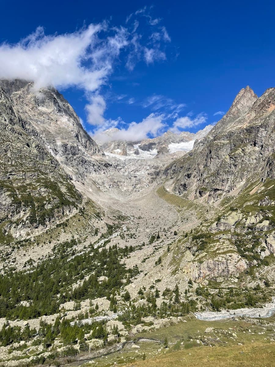
Experience the varied landscapes of the Cadí-Moixeró Natural Park, from Mediterranean woods to alpine meadows
Trek through a circuit of eight charming mountain huts, each with its unique character and history
Enjoy the culinary delights of mountain cuisine, from hearty soups to traditional rice dishes
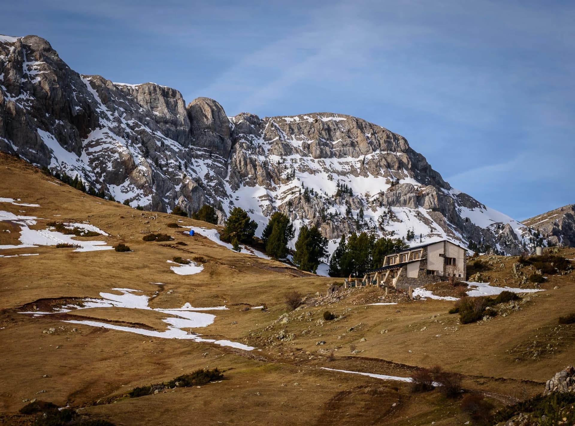
Experience breathtaking views from Niu de l’Àliga, the highest wardened hut in the Pyrenees
Join with the historic Route of the Cathars, a long-distance path rich in cultural heritage
Discover the diverse wildlife in the park, from golden eagles and black woodpeckers
Itinerary
On your first day, you’ll arrive at La Molina by train, which can be reached from various parts of Spain. Once there, you have two options for the Niu de l’Àliga hut: either take a straightforward chairlift right to the refuge or hike there. The hike is 7.5 kilometers long, with an uphill climb of 900 meters. It’s physically demanding, but in this case, you won’t have to pay for the chairlift. After your journey, you’ll stay overnight at the Niu de l’Àliga hut.
7.5 km and 930 m of elevation gain
On day two, the path descends from La Tosa through open woodlands and meadows, leading to Coll de Jou and up to Penyes Altes at 2,279 meters. As you weave through lush alpine meadows, you’ll be surrounded by diverse flora and fauna, including grazing livestock and wild choughs. The trail, marked by a mix of meadows, forest, and a rocky section with a rope for assistance, culminates at the charming Serrat de les Esposes hut.
13.3 km and 430 m of elevation gain / 1450 m of elevation loss
On the third day, you’ll cover a distance some people break into two stages, which is unnecessary due to both being relatively short. Midway, you’ll intersect with the historic Route of the Cathars (GR107), leading you past the refreshing Font Freda and through dense woodlands abundant with wildlife, including chamois. You’ll then ascend to Prat de les Estelles, following a stream to Coll de Vimboca. The trail, once used by smugglers, transitions into alpine meadows and Spanish pine, taking you to breathtaking viewpoints at Pradell and Pas dels Bous. The day ends as you leave the Moixero range, enter the Cadi region, and finally arrive at the scenic Prat d’Aguiló.
16.7 km and 1000 m of elevation gain / 530 m of elevation loss
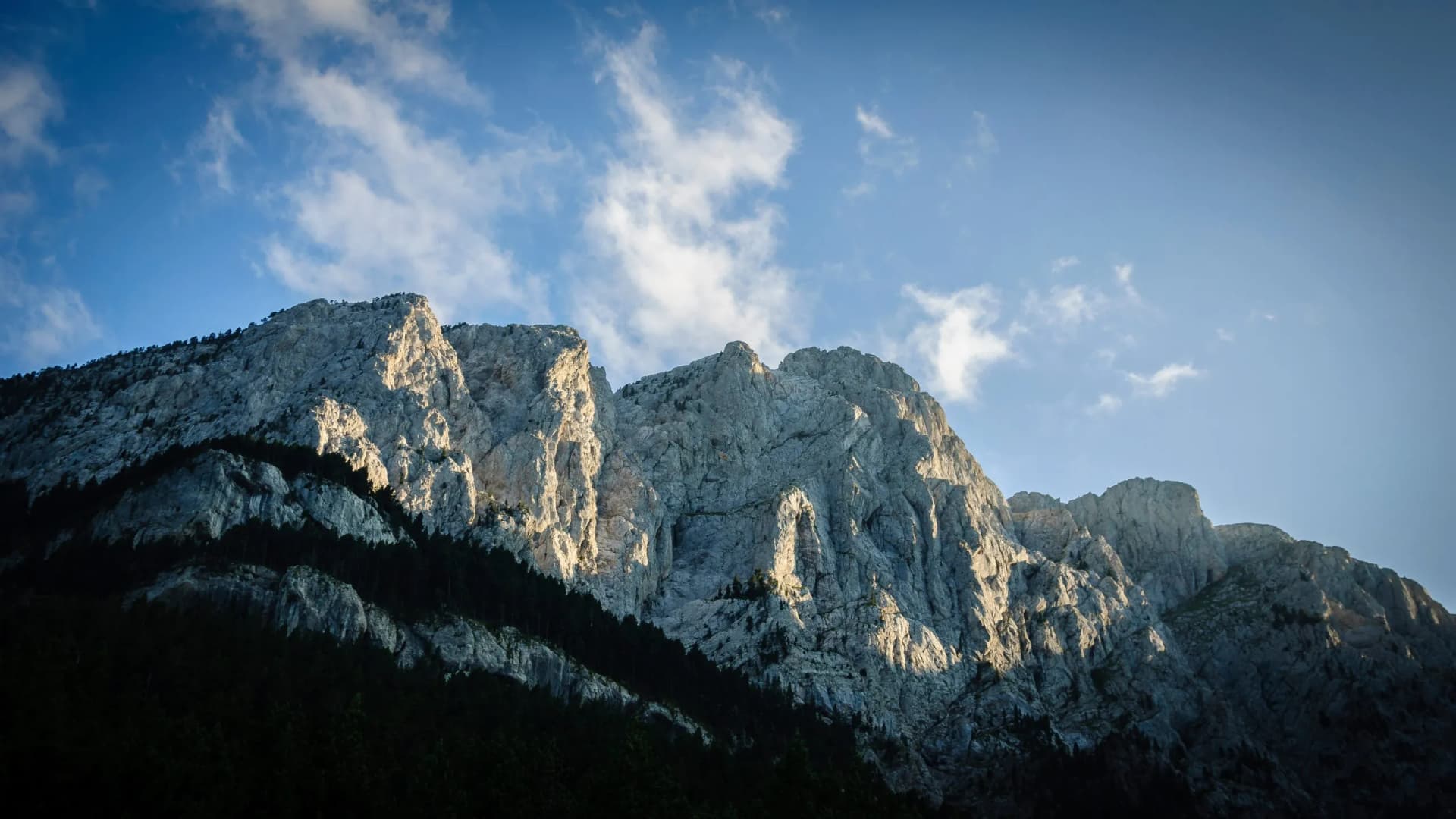
On this segment of your hike, you’ll start at the Prat d’Aguilo hut, a base for climbers heading to the north face of the Cadi. The journey up the PR124, or the Route of the Reapers, is a steady but panoramic climb through meadows and scree to the Pas dels Gosolans at 2,243 meters. As you traverse the Serra Pedragosa ridge and descend to El Collell, the vegetation shifts from pine forests to lush beechwood in the Gresolet Valley. The path to the Lluís Estasen hut, though long, rewards you with continuous views of the iconic Pedraforca mountain, its distinct shape a highlight of the Catalan landscape.
12.3 km and 500 m of elevation gain / 870 m of elevation loss
Leaving the Lluis Estasen hut, named for a rock-climbing pioneer, your next destination is Gresolet, descending through the Jaca del Prats. Arriving in the valley, you’re greeted by the Gresolet hut in a wooded valley featuring a picturesque lawn with views of Pedraforca. The hike to Gresolet is short, so you’ll continue to the next refuge. The journey takes you through dense beechwoods to the Coll de la Bauma. As you continue, the scenery changes to a Mediterranean landscape with fragrant thyme and lavender. After a steep and engaging climb through a gorge filled with charming waterfalls, including the remarkable El Bullidor de la Llet, you reach the Sant Jordi hut.
16.7 km and 1130 m of elevation gain / 1170 m of elevation loss
Your route from the Sant Jordi initially descends to Ca l’Escriu on the GR107, followed by an ascent to Coll d’Escriu, surrounded by beech and pine trees. From here, you follow a lengthy descent through stunning beechwoods to Greixer, crossing roads and a river. The final part of the journey is a steep climb through fields to the house of Millares. The day’s last stretch, a 30 to 45-minute climb through Scots pine and box, leads to Rebost. Despite the day’s rigor, with frequent changes in elevation and the anticipation of reaching the hut at each turn, you’re ultimately rewarded with magnificent views of Pedraforca and the surrounding mountains.
11 km and 820 m of elevation gain / 760 m of elevation gain
On your final day, you’ll leave from Rebost toward the place where it all started. The trail ascends continuously, initially meandering through meadows and forests with stunning views. However, as you surpass 2,000 meters in altitude, the environment transforms into a rockier terrain with sparse vegetation. Eventually, you reach the Niu de l’Àliga hut, perched at the highest point of La Molina ski resort on La Tosa mountain at 2,537 meters. You’ll spend your last night in the so-called Eagle’s Nest.
6 km and 930 m of elevation gain / 50 m of elevation loss
On your final morning, after waking up in the Niu de l’Àliga hut and enjoying breakfast amidst the stunning panorama of Alt Bergueda, you have two options for concluding your adventure. For a leisurely end to the journey, you can take a chairlift down to the valley, a scenic and relaxing descent that offers a unique perspective of the landscapes you’ve traversed. Alternatively, if you’re up for one last trek, you can hike down to La Molina. Once at La Molina, you can conveniently catch a train to the airport.
7.5 km and 900 m of elevation loss
Want to make some changes?
Guided
Included in price
Optional Extras
Self guided
Included in price
Optional Extras
What to bring to the tour
Description
Weave through the stunning landscapes of Catalonia’s Cavalls del Vent or ‘Horses of the Wind.’ This famed circuit links eight rustic mountain huts within the breathtaking Cadí-Moixeró Natural Park, sprawling across the Berguedà and Cerdanya counties.
Encompassing over 80 kilometers of trails, you’ll traverse a rich tapestry of Mediterranean forests, expansive meadows, and rugged mountains, each offering a unique vista and challenge.
You’ll be captivated by the shifting scenery, from the serene Bastareny River valley to the lofty heights of Niu de l’Àliga. Along the way, the path is dotted with picturesque huts, each a welcoming haven offering basic amenities and the simple pleasures of mountain cuisine.
The Cavalls del Vent is a moderately challenging trek, suitable for a wide range of hikers. While the route isn’t technically demanding, it includes sections with significant elevation changes and longer distances.
As the journey is circular, it offers flexibility to tailor the experience to your fitness level. However, do note that luggage transfer is not an option on this self-sufficient adventure.
Our commitment to you extends beyond the trail. We ensure a seamless experience by booking all huts along your journey, providing round-the-clock support, GPS navigation, and an in-depth travel booklet about Cavalls del Vent.
This comprehensive preparation allows you to immerse fully in the adventure, with the comfort of knowing every detail is taken care of.
Trail Map
Start planning today!
Things to know
Hut-to-hut hiking is a form of trekking where you hike from one mountain refuge to another, staying overnight at these locations. This style allows you to explore the varied landscapes of the Pyrenees, from high mountain passes to serene valleys, without the need for carrying camping gear. The trails, such as the famous GR10 and GR11, connect different refuges and offer diverse scenic experiences.
Preparation involves physical training, familiarizing yourself with the hiking routes, and ensuring you have the right gear. Start with cardiovascular exercises and hikes to build endurance. Study the specific trails you plan to hike, as each has unique characteristics, and pack accordingly for varying weather conditions and terrains.
While some hiking experience is beneficial, the Pyrenees offer trails suitable for various skill levels. Beginners can enjoy less challenging routes with lower elevation gains, while experienced hikers can tackle more strenuous paths. But most trails in the Pyrenees require some previous experience, mostly due to large distances and elevation gains.
The Pyrenees feature a range of refuges, from basic, unmanned shelters offering minimal amenities to manned refuges with facilities like meals and hot showers. All our hikes include only staffed huts in order to provide the maximum comfort possible.
Sleeping arrangements in Pyrenees refuges vary. Some offer private rooms, while others only have shared dormitories. It’s essential to book in advance, especially during peak seasons, to secure the type of accommodation you prefer.
Refuge etiquette in the Pyrenees centers around respect for shared spaces and other hikers. Clean up after yourself, keep noise levels low, especially at night, and adhere to the specific rules of each refuge.
The ideal season is from late spring to early fall, typically June to September. This period offers more stable weather conditions and open refuges. However, be prepared for rapid weather changes, especially in higher altitudes.
Meals are provided in all staffed refuges, often including breakfast and dinner. Some refuges might offer packed lunches for the next day’s hike. It’s wise to carry snacks, especially for longer hiking segments.
Stay on marked trails, be aware of weather changes, and carry a basic first aid kit. For emergencies, know the local rescue services (112) and have a means to call for help. We provide support and check-ins to ensure your safety throughout your hike.
Although our suggestion would be that they are at least 12 years old, many hikes are suitable for children who are accustomed to hiking and can handle distance and elevation changes. Assess your child’s ability and choose a trail that aligns with their experience and stamina.
Weather in the Pyrenees can vary significantly, with warmer conditions in the lower valleys and cooler temperatures at higher elevations. Summers are generally mild, but conditions can change rapidly in the mountains, so be prepared for all scenarios.
Yes, advance booking is crucial, particularly if you prefer specific types of accommodation or are hiking during the busy season. Refuges, especially the more popular ones, can fill up quickly.
In mild bad weather, such as rain, it’s usually safe to continue your hike with appropriate gear. For severe weather conditions like heavy storms, it’s advised to stay in your current refuge until it’s safe to proceed. Always prioritize safety and follow the guidance of hut wardens or local authorities. We’ll try our best to adapt your itinerary accordingly.
The availability of specific dietary options varies between refuges. Most manned refuges offer vegetarian meals, but vegan options might be limited. It’s recommended to inform the refuge in advance of any dietary restrictions. Carrying additional food items to supplement provided meals is a good practice.
Cell phone reception in the Pyrenees can be spotty, especially in remote areas or higher altitudes. Some refuges may offer Wi-Fi, but it’s not common. Prepare for limited connectivity, which is a part of the remote mountain experience.